Phoenix flood zones you should check before buying
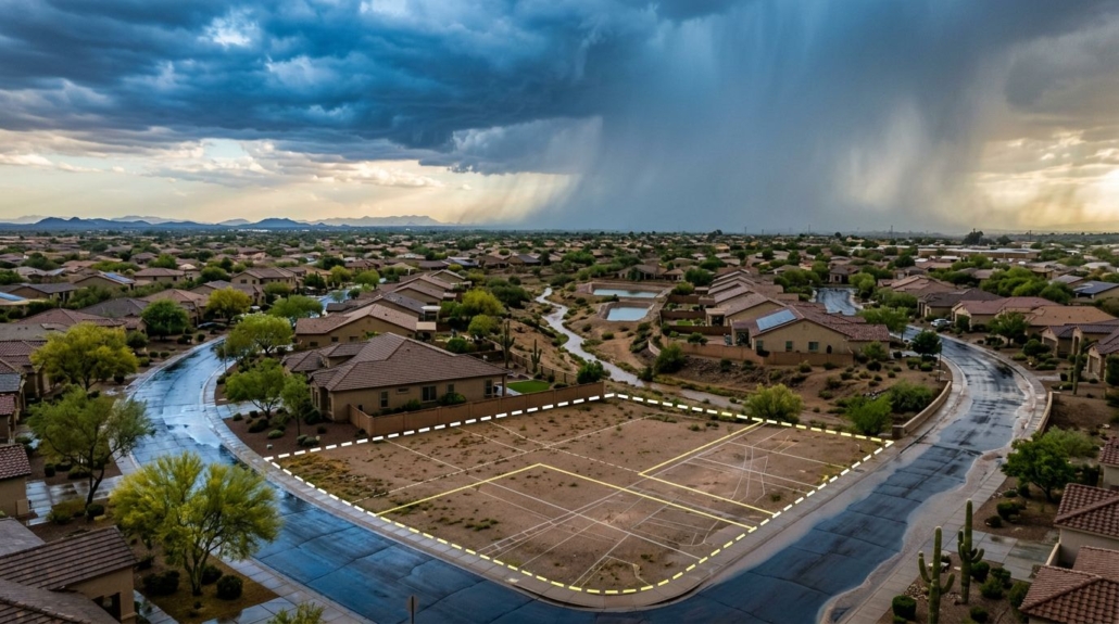
A dry yard can fool you in Phoenix. Then a monsoon storm rolls through, the street fills up, and you find out exactly where the water wanted to go.
Before you fall in love with a kitchen or picture your kids in the backyard, check the Phoenix flood zones tied to the address. This is not about scaring yourself out of a good home. It is about understanding the property flood risk, what it may cost, and whether the house works for your family when severe weather hits.
Researching the specific Phoenix flood zones for your property is essential before making a purchase.
Understanding Phoenix flood zones is crucial for making an informed decision on your property investment.
Let’s walk through the essential flood hazard information I want every buyer to look at before the inspection period gets away from them.
Be aware of how the local Phoenix flood zones can affect your home’s value and insurance requirements.
Buyers should prioritize learning about Phoenix flood zones to mitigate potential risks associated with their new home.
Key Takeaways
- FEMA flood maps are the starting point, but local drainage maps and the actual lot matter too.
- A 100-year flood means a 1% annual flood chance, not a flood that happens once every century.
- Flood irrigation is common in older Phoenix neighborhoods and isn’t the same as a FEMA flood hazard.
- Walk the street after rain if you can, and pay close attention to washes, drainage easements, curbs, and low spots.
- Get flood insurance quotes and ask clear questions before you remove inspection contingencies.
What Phoenix flood zones actually tell you
Understanding the different classifications within Phoenix flood zones can greatly aid your property assessment.
Familiarizing yourself with Phoenix flood zones helps in predicting how your property might fare during heavy rains.
The phrase “100-year floodplain” has caused a lot of unnecessary confusion. It does not mean a home will flood once every 100 years. Instead, a 100-year flood simply means the area has at least a 1% chance of flooding in any given year.
Each home within Phoenix flood zones has unique attributes that require careful analysis.
That may sound small. Over a 30-year mortgage, FEMA says a property in high risk flood areas has at least a one-in-four chance of experiencing a flood. You can review the underlying definitions, flood zone definitions, and search tools through the FEMA Flood Map Service Center.
It’s essential to know how Phoenix flood zones can affect your insurance rates and home value.
Factors like elevation and proximity to known Phoenix flood zones play a significant role in insurance costs.
When looking at FEMA flood maps, the common map labels are fairly straightforward:
| Flood zone | What it usually means for a buyer |
|---|---|
| A or AE | A high risk flood area, often called Special Flood Hazard Areas |
| X, shaded | Moderate flood risk |
| X, unshaded | Lower mapped risk, covering low and moderate risk zones, though not zero risk |
| Floodway | The channel area where floodwater must move, with tighter building limits |
Zone AE often includes a defined Base Flood Elevation. Zone A may not, though you can often request a Base Flood Elevation determination from local engineering records. Either way, don’t treat a flood zone designation as a final verdict on a home’s condition, especially when reading older flood insurance rate maps.
Understanding the boundaries of Phoenix flood zones is crucial when evaluating potential home purchases.
Understanding Phoenix flood zones will empower you to choose wisely when it comes to home buying.
I’ve seen buyers get spooked by an A-zone label, even when the house was properly elevated and well maintained. I’ve also seen people shrug off an X-zone property on FEMA flood maps, even though the driveway sloped toward the garage and the side yard held water like a bathtub.
Be proactive about your home’s location concerning the Phoenix flood zones to ensure safety.
A map tells you where risk has been studied. It doesn’t tell you whether last summer’s storm sent water toward the front door.
Paying attention to details regarding Phoenix flood zones can save you from future headaches.
Your awareness of the neighborhood’s history with Phoenix flood zones can influence buying decisions.
For an address-specific starting point, Phoenix points residents to the Flood Control District’s floodplain information. Use it early, before you’re emotionally attached to the house.
Phoenix flood zones are only one part of the picture
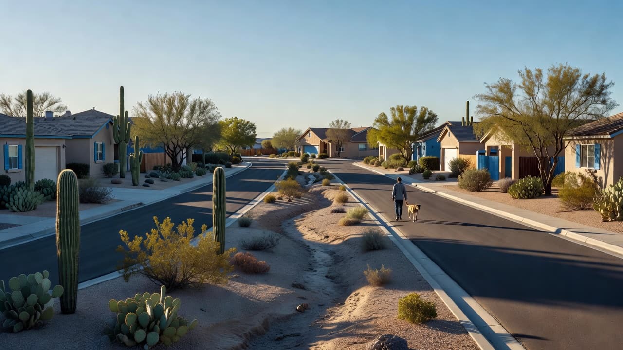
Phoenix is desert country, but water moves fast here. Hard-packed soil doesn’t soak up a heavy downpour the way people expect. Streets, block walls, driveways, roof lines, and backyard grading all push that water somewhere.
When considering a property, always factor in how Phoenix flood zones might influence drainage patterns.
This is where people get stuck. They check FEMA flood maps, see a lower-risk X zone, and decide the question is answered. It isn’t, especially when you consider property flood risk at the neighborhood level and how topography and drainage actually function during a monsoon storm.
I want you to look at the street and the lot with the same attention you give the roof and air-conditioning system. Is the home at the low end of the block? Does a driveway slope into the garage? Are there visible water stains at the base of block walls? Does the backyard have drains, swales, or a low corner full of gravel?
A wash deserves extra attention. Unlike areas prone to coastal flood risk, our desert washes sit dry most days, but they have a job when rain arrives. Don’t assume a nice-looking fence, filled-in landscaping, or a neighbor’s backyard project has changed that job.
Ask for the recorded plat and look for drainage easements. The county’s flood-risk resource guide recommends checking plats for drainage tracts and easements, including who is responsible for maintenance. Sometimes a local flood control system or street design diverts water into shallow flooding areas that FEMA flood maps miss entirely.
Researching Phoenix flood zones is part of due diligence required for homebuyers.
For homebuyers, understanding Phoenix flood zones can be the difference between a wise investment and a regrettable one.
For parents, think beyond the building. Can your kids safely walk or bike through the area after a hard rain? Is the normal route to school, a park, or a grandparent’s house affected by a wash crossing? For a downsizer, ask an equally practical question: can you get in and out comfortably if a storm hits during an appointment or errand?
Don’t confuse flood irrigation with flood risk
Educating yourself about Phoenix flood zones can lead to more informed real estate decisions.
Keep in mind that not all properties within Phoenix flood zones are equally at risk.
This one trips up newcomers all the time.
Flood irrigation is a planned way of watering a property. Water enters a yard through an irrigation system, then flows across the lot on a schedule. It can support beautiful mature trees and green yards in older parts of Phoenix. It is not the same thing as having an active flood zone designation or showing up as hazardous on FEMA flood maps.
North Central Phoenix, Uptown Phoenix, and Arcadia have homes where flood irrigation is part of the property’s character. In some cases, it is a real benefit. The trees are older, the lots feel cooler, and the landscape has a look you won’t get in a newer subdivision.
But the yard needs to work with the irrigation system. That means gates, grading, patios, sheds, drainage openings, and landscaping choices all matter. If the water can’t move as intended, it can pool where you don’t want it.
Knowing about Phoenix flood zones gives you insight into potential water issues around the property.
Consider how your lifestyle will be affected by the proximity to Phoenix flood zones when choosing a home.
If you’re considering an older property, my advice is simple: ask whether it has irrigation rights, how often the water runs, where it enters, and where it exits. My guide to flood-irrigated lots in North Central Phoenix gives you a better feel for what that can mean day to day.
A seller’s lush lawn is not a problem. It’s a reminder to ask the next question.
It’s important to recognize how Phoenix flood zones play into the broader context of home buying.
Understanding how Phoenix flood zones interact with local infrastructure is crucial for smart buyers.
What to check during the inspection period
You don’t have to become a drainage engineer. You do need to ask enough questions that surprises don’t show up after closing.
Start with your agent, inspector, and insurance contact. Then make sure the answers line up.
Here is the short list I use with buyers:
- Pull FEMA flood maps and the local floodplain map using the exact street address and parcel number to complete a thorough flood risk assessment.
- Ask the seller for prior flood claims, water intrusion repairs, drainage work, elevation certificates, and insurance information.
- Read the seller’s property disclosure carefully, then ask follow-up questions in writing if anything is unclear regarding past water issues and building requirements.
- Have the home inspector look for grading issues, roof drainage, foundation cracks, wall staining, and signs of repeated moisture that highlight flood damage potential.
- Get a flood insurance quote before the end of your inspection period, even if the lender doesn’t require it, keeping in mind how insurance requirements can vary.
- Review official FEMA flood maps alongside National Flood Insurance Program guidelines to understand your potential obligations.
- Check policies under the National Flood Insurance Program so you know what coverage options exist for your specific parcel.
- Secure official flood insurance details early, and verify how flood insurance rates apply to the structure.
- Visit after rain when possible. If that doesn’t work, walk the street and look for debris lines, curb cuts, drains, washes, and low spots.
If a federally backed lender determines the home is in a Special Flood Hazard Area, flood insurance is generally required. A buyer may also choose coverage outside that area. The price, availability, and required coverage can change based on the home, elevation, map status, and insurer, so get a real quote for the actual address.
Don’t accept “we’ve never had a problem” as the end of the conversation. It may be true. It may also mean the current owner hasn’t lived there through the right storm.
Areas where I slow down and look harder
Consider how the specifics of Phoenix flood zones can impact both your living experience and your investment.
The specific characteristics of Phoenix flood zones should inform your purchasing strategy.
I don’t paint entire ZIP codes with one brush. There are homes with drainage questions and homes with solid answers on every side of town. Still, some property types make me slow down, especially when evaluating high risk flood areas where drainage paths matter most.
In Arcadia and North Central Phoenix, older homes with irrigation and mature landscaping need a closer look at yard flow. A remodel may have added patios, walls, turf, or hardscape that changed how irrigation water moves, which can mimic issues found in high risk flood areas. If you’re looking there, these Arcadia irrigation and yard-maintenance details are worth understanding before you make assumptions.
In the Sheaborhood, or 85028, I pay attention to lots near natural drainage paths and the foothill edge. The view is great. The terrain can also create a more obvious path for stormwater, occasionally intersecting with designated Special Flood Hazard Areas. A property doesn’t need to be in a mapped zone for lot grading to matter, especially when reviewing local flood hazard information.
The same goes for Northeast Foothills Phoenix in 85020 and parts of North Paradise Valley Village in 85032. Homes near washes, slopes, or open drainage areas deserve a second look, while analysts monitor regional climate change impacts on severe monsoon storms that test the local flood control system. For a family with younger kids, I also want to know how a storm changes the route through the neighborhood.
Map boundaries can change over time. If the map seems wrong, don’t guess. Maricopa County explains the process for flood-map updates and Letters of Map Change, often utilizing a Floodplain Delineation Study to refine flood insurance rate maps across neighborhoods that span low and moderate risk designations. Whether you are dealing with National Flood Insurance Program standards or trying to verify a Base Flood Elevation, an existing elevation certificate may answer a lot of questions. It can be worth tracking down before you walk away from an otherwise good home, particularly if you need to challenge incorrect flood insurance rate maps or pursue a formal Letter of Map Change to determine your true Base Flood Elevation and secure appropriate coverage through the National Flood Insurance Program without paying for zones meant for coastal flood risk or low and moderate risk areas alike.
Keep in mind that understanding Phoenix flood zones can lead to a more secure investment.
Knowledge of Phoenix flood zones not only helps assess risks but can also enhance negotiation leverage.
Frequently Asked Questions
Do FEMA flood maps tell the whole story about flood risk in Phoenix?
No, FEMA maps only show regional and macro-level risk based on historical data. Local factors like lot grading, street slope, block walls, and nearby washes can significantly impact a property’s actual vulnerability during a monsoon storm.
Is flood irrigation the same as being in a FEMA flood zone?
Not at all. Flood irrigation is a scheduled, managed system used to water mature trees and yards in older Phoenix neighborhoods like North Central and Arcadia, whereas a FEMA flood zone designates areas with a statistical risk of stormwater flooding.
Should I get flood insurance even if my lender doesn’t require it?
Yes, it is often wise to get a real quote during your inspection period. Standard homeowners insurance does not cover flood damage, and localized downpours can cause water intrusion even in lower-risk zones where lenders do not mandate coverage.
What are the best ways to check a property’s drainage during the homebuying process?
Review the recorded plat for drainage easements, ask the seller for a thorough disclosure regarding past water issues, have your inspector check for foundation staining or grading problems, and visit the neighborhood after a heavy rain if possible.
The right answer is a clear answer
In conclusion, knowing about Phoenix flood zones is key to making a smart purchase.
A home in a Phoenix flood zone isn’t automatically a bad purchase. A home outside one isn’t automatically worry-free. The best decision comes from looking at Phoenix flood zones, the lot, the disclosures, the inspection findings, and your future flood insurance costs together.
Thorough research on Phoenix flood zones will empower buyers to make informed decisions.
I’ve helped a lot of families through this exact situation. The buyers who feel good after closing aren’t the ones who ignored the question. They’re the ones who performed a thorough flood risk assessment and got straight answers about property flood risk before the house became theirs.
Buyers who assess the implications of Phoenix flood zones are likely to find lasting satisfaction in their new homes.
Ultimately, understanding Phoenix flood zones can lead to a safer and more satisfying home ownership experience.
A little homework now can prevent a long, expensive surprise later.
Being well-informed about Phoenix flood zones can significantly mitigate future risks.